











Lucipara
Type “lucipara” into Google and you’ll hit a wall of vague, recycled travel blurbs — pretty language about “hidden paradise” with almost no verifiable facts. If you actually want to know where Lucipara is, what it looks like underwater, and whether you could ever visit, that gap is frustrating.Here’s the good news: Lucipara is real, it’s well worth understanding, and the confusion around it has a simple explanation. This guide breaks down exactly where the Lucipara Islands sit, what makes them ecologically important, how people actually reach them, and — because the name is genuinely shared — what Euplexia lucipara, a European moth, has to do with any of this.
What Is Lucipara? A Quick Answer
Lucipara most commonly refers to the Lucipara Islands (Indonesian: Kepulauan Lucipara), a small, uninhabited cluster of coral islands in the Banda Sea, part of Indonesia’s Maluku province. They sit roughly 200 kilometers south of Ambon, are reachable only by boat, and are known for healthy coral reefs and resident sea turtle populations. Separately, Euplexia lucipara is the scientific name of the Small Angle Shades, a common moth found across Europe and temperate Asia — unrelated to the islands except for the shared Latin word “lucipara.” & more blogs to see generally .
Where Are the Lucipara Islands Located?
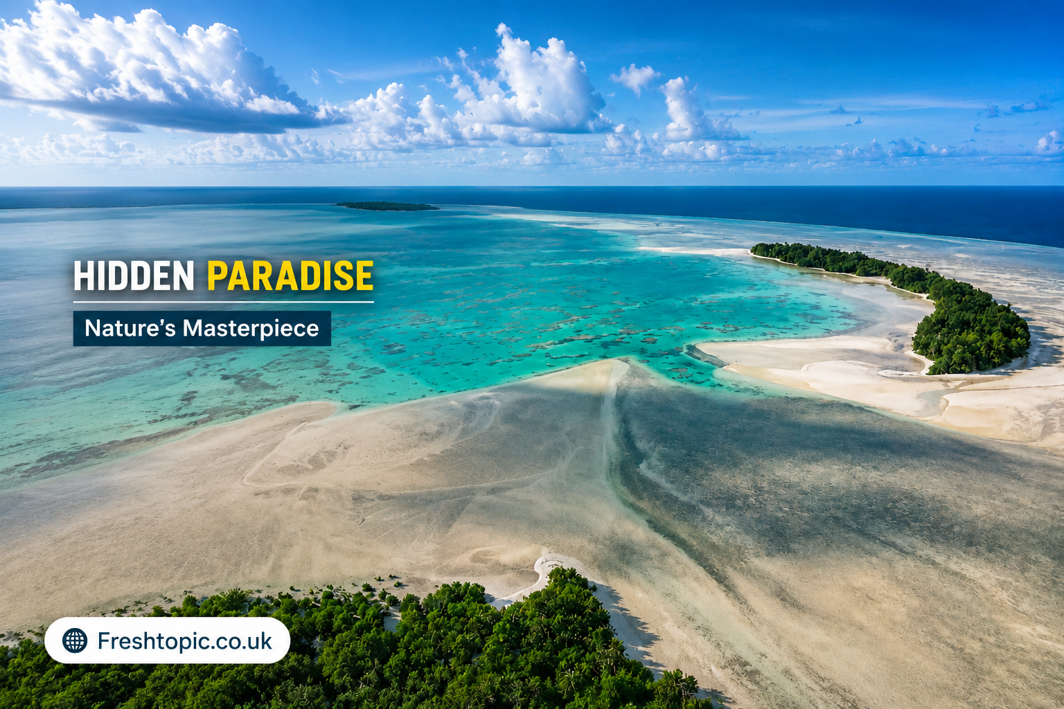
The Lucipara’s Islands lie in the middle of the Banda Sea, one of the deepest and most biologically rich seas in Indonesia. They are located near 5.4943° South and 127.5423° East, roughly 50 kilometers from the Penyu (Turtle) Islands, and appear from above as a small cluster of coral cays and reef flats rather than a single landmass.
Coordinates and Distance From Ambon
Multiple travel and expedition accounts place Lucipara’s roughly 200 kilometers south of Ambon in the middle of the Banda Sea, with the journey by boat taking approximately 15 hours under favorable conditions. That distance and travel time alone explain why the islands remain so lightly documented compared to Bali, Raja Ampat, or Komodo.
Other Names for Kepulauan Lucipara
Because the islands appear on old Portuguese and Dutch navigational charts, they carry several historical spellings. Kepulauan Lucipara is also known as the Lousapara Islands, Lucapin Islands, Lucipara Eilanden, and Lusipari Islands . If you’re researching the area, searching these alternate names alongside “lucipara islands” and “kepulauan lucipara” can surface additional expedition logs and nautical records.
Why This Matters
Most of Indonesia’s famous dive and travel destinations — Bali, Raja Ampat, Komodo — are documented extensively. Lucipara isn’t. That obscurity is exactly why it matters:
- It’s a rare ecological baseline. Reefs with minimal human contact give scientists a reference point for what a “healthy” reef system looks like before fishing pressure and tourism development.
- It sits inside a conservation gap. The Banda Sea has few formally protected zones this remote, which makes unregulated fishing and marine debris a real long-term risk even in isolated waters.
- It illustrates a broader pattern. Thousands of Indonesia’s smaller islands remain undocumented online, which matters for travelers, researchers, and conservation planners trying to prioritize limited resources.
What the Lucipara Islands Are Like
Geography and Coral Reefs
The islands sit atop a reef platform rising from the notoriously deep Banda Sea basin. They are small and remote, surrounded by deep water and coral reefs, and the surrounding area historically served as a landmark for spice-trade shipping routes between the Banda Islands and wider trading ports.
Sea Turtles and Marine Life
Sea turtles are the single most consistently reported feature of Lucipara across expedition accounts. The islands are noted as famous for their resident sea turtles , and independent dive and research trips describe healthy fish populations, reef sharks, and pelagic species passing through the surrounding waters. Because the area receives so little fishing or boat traffic, wildlife sightings tend to be denser than in more accessible parts of the archipelago.
No Villages, No Infrastructure
There are no hotels, no dive shops, and no permanent settlements. Access depends entirely on chartered or research vessels, and <cite boats can typically only reach the islands during a short window each year around the change of the monsoon. Anyone researching a visit should treat that seasonal window as a hard constraint, not a suggestion.
How to Get to the Lucipara Islands
Step-by-Step Access Route
- Fly into Ambon, the main transport hub for Maluku province.
- Arrange a liveaboard or research-vessel charter — there is no scheduled public transport to Lucipara.
- Plan around the monsoon transition, the narrow seasonal window when sea conditions allow the crossing.
- Budget roughly 15 hours of open-water travel each way from Ambon.
- Bring everything you need. With zero infrastructure, self-sufficiency for food, water, fuel, and medical supplies is essential.
One documented example: in 2019, a small expedition aboard the vessel MV Oceanic — including a marine scientist from a university in Ambon and a Tubbataha National Park manager from the Philippines — made the crossing specifically to survey the islands and their turtle population, illustrating just how specialist this kind of trip remains.
Lucipara Islands vs. Nearby Destinations
| Feature | Lucipara Islands | Banda Islands | Raja Ampat |
|---|---|---|---|
| Access | Charter/research boat only, seasonal | Regular boats/flights via Ambon | Flights + boat, established tourism |
| Infrastructure | None | Guesthouses, dive operators | Resorts, liveaboards, dive shops |
| Population | Uninhabited | Inhabited towns | Inhabited, tourism-developed |
| Known for | Sea turtles, untouched reefs | Spice-trade history, volcanic scenery | Reef biodiversity, manta rays |
| Best suited for | Researchers, specialist expeditions | General travelers, history buffs | Divers, mainstream eco-tourism |
Pros and Cons of Visiting Lucipara
Pros
- Genuinely untouched reef and marine life
- Minimal crowds — arguably none
- A rare, near-baseline ecological environment
- Strong appeal for serious divers and researchers
Cons
- No infrastructure, medical support, or emergency services
- Extremely limited and weather-dependent access window
- High cost and logistical complexity of chartering a vessel
- Very little independently verified information available online
Mistakes to Avoid When Researching or Planning a Trip
- Don’t trust generic “hidden paradise” blog posts at face value. Several recent articles about Lucipara recycle the same vague claims without citing sources — cross-check specifics like coordinates and distances where possible.
- Don’t assume it’s bookable like a resort island. There’s no tourism board, no fixed itinerary, and no guaranteed departure schedule.
- Don’t ignore the monsoon window. Attempting the crossing outside the seasonal transition period is a real safety risk.
- Don’t confuse it with Euplexia lucipara. If your research keeps surfacing moth photography instead of island travel logs, refine your search to “Kepulauan Lucipara’s” or “Lucipara’s Islands Banda Sea.”
Not the Islands? Meet Euplexia lucipara, the Small Angle Shades Moth
If you landed here searching “euplexia lucipara” specifically, you’re after a completely different subject: a moth, not an island.
The Small Angle Shades (Euplexia lucipara) is a moth of the family Noctuidae, first described by Carl Linnaeus in 1758, and it’s distributed throughout the Palearctic region. It’s common and widespread across most of the British Isles, found in woodland, parkland, and suburban habitats, with adults typically flying in June and July and sometimes a second generation in August and September. Its range extends beyond Britain across temperate Europe and Asia as far as Japan , and it has a distinctive resting posture, folding its forewings in a way that resembles a dead leaf.
Identification-wise, it’s a small, largely unmistakable moth sharing a resting posture similar to the Angle Shades, with a gold-yellow kidney-shaped mark set against a broad purplish-black central band . Scientists have even sequenced its full genome:the assembly spans 661.8 megabases across 31 chromosomal pseudomolecules, including the Z sex chromosome, with 20,395 protein-coding genes identified. The overlap in naming is coincidental — both “lucipara” the moth species epithet and “Lucipara” the island group trace to unrelated etymological roots, one Latin-scientific, one historical-maritime.
Expert Recommendations
- Travelers and divers: Treat Lucipara’s as an expedition, not a holiday. Book through operators with documented prior Banda Sea experience, and confirm insurance covers remote maritime evacuation.
- Researchers and students: Prioritize primary sources — expedition logs, university marine science departments in Ambon, and Indonesian government marine affairs publications — over undated travel blogs.
- Content researchers and writers: Because so little verified data exists on Lucipara, cite specific, checkable details (coordinates, named expeditions, named institutions) rather than repeating unattributed superlatives.
- Naturalists searching for the moth: Use “Euplexia lucipara” plus a regional moth recording site (e.g., a national moth society) for verified sightings and distribution maps rather than general search results.
Conclusion
Lucipara isn’t one story — it’s two unrelated ones sharing a single search term: a barely-documented coral island group in one of Indonesia’s deepest, wildest seas, and a small, well-studied moth found in gardens across Europe. Whichever one brought you here, the throughline is the same — Lucipara rewards people willing to look past the vague, recycled summaries and dig for specifics.
FAQs
Where is Lucipara located?
The Lucipara Islands sit in the Banda Sea, part of Indonesia’s Maluku province, roughly 200 kilometers south of Ambon.
Is Lucipara inhabited?
No. The islands have no permanent villages, hotels, or infrastructure, though some families reportedly maintain traditional ties to the area.
How do you get to the Lucipara Islands?
By chartered boat or research vessel from Ambon, typically only during the seasonal monsoon transition window, with the crossing taking around 15 hours.
Is Lucipara a marine protected area?
As of current public information, Lucipara’s is not confirmed as a formally established, legally protected marine area, though conservation groups and researchers have discussed its potential for protected status due to its healthy reefs and sea turtle populations.
What is Euplexia lucipara?
Euplexia lucipara is the scientific name of the Small Angle Shades, a noctuid moth common across Europe and temperate Asia, unrelated to the Lucipara Islands.
Why do “Lucipara” and “Euplexia lucipara” share a name?
It’s coincidental — the moth’s species name comes from Latin scientific naming conventions, while the islands’ name has separate historical-maritime origins.
Can tourists visit the Lucipara Islands?
Technically yes, but only via private charter or specialist expedition — there is no scheduled tourism access, accommodation, or infrastructure.
In Short
- Lucipara’s most often refers to the Lucipara Islands (Kepulauan Lucipara), a remote, uninhabited coral island group in Indonesia’s Banda Sea, about 200 km south of Ambon.
- The islands are known for healthy coral reefs, resident sea turtles, and near-total isolation, accessible only by boat during a narrow seasonal window.
- Historical names include Lousapara, Lucapin, and Lucipara’s Eilanden.
- Euplexia lucipara’s is an unrelated moth species (Small Angle Shades), common across Europe and temperate Asia, first described by Linnaeus in 1758.
- Reliable, source-checked information on the islands is scarce online — verify claims against named expeditions, institutions, or coordinates where possible.